The Tatras Mountains: A Picturesque Hike Between Two Countries
A Mountain Range That Divides Countries
With a total length of 60 km, the Tatras Mountains represent the highest part of the Central Carpathian Mountains, a 1,500 km-long mountain range winding its way through Central and Eastern Europe, all the way from Czech Republic to Moldova. The Tatras are further divided into four parts (Belianske Tatras, Western Tatras, High Tatras, and Siwy Wierch) out of which the High Tatras are by far the most impressive. With an unreal scenery comprising sharp rocks, crystal clear mountain lakes and dramatic peaks, the High Tatras are a perfect but quite unknown destination for hikers, adventurers, and nature lovers. The coolest aspect of this mountain range is that it creates a natural border between Poland and Slovakia. With both countries located within the Schengen zone, no physical borders exist. This makes it possible to hike between two countries on the same day.
How to Get to the High Tatras
Due to its large size and uncountable hiking trails, there are multiple ways to get to the High Tatras range, depending on the country of origin. From Poland, Zakopane represents the closest city with a distance of only 60 km, followed by Krakow with a distance of 144 km. From Slovakia, Bratislava is the closest city, with a distance of 340 km. All of these distances refer to Strbske Pleso, the main tourist hotspot on the southern side of the High Tatras in Slovakia. Getting there is fairly easy by either car or train. Road structures are excellent and well mapped when using GPS services.
Where to Stay
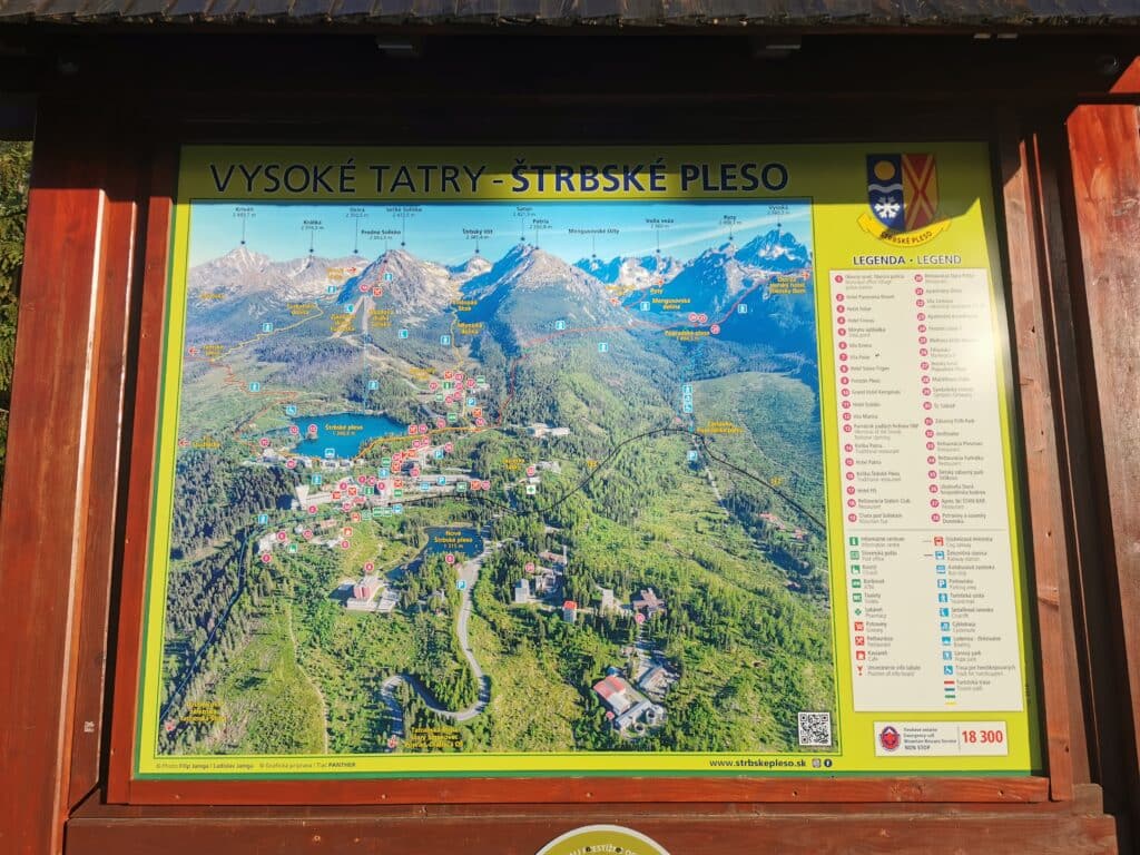
When planning to hike up the High Tatras mountains, leaving early is key, since the ascent is demanding and takes a long time. Staying as close as possible to the entrance of the mountains is advisable. However, as in every main tourist area, prices can be high. This is why I suggest you don’t book a hotel in Strbske Pleso, Slovakia itself, but in the nearby town of Velka, which is only 30 minutes east of Strbske Pleso. (see map below)
Entering the High Tatras as Early as Possible
During my road trip in 2020, I traveled from Bratislava and arrived at my hotel in Velka late on a Friday night. After six hours of sleep, I began making my way to Strbske Pleso at 05.30 and arrived the official parking lot at 6.00. The parking is split into zones (green, red, and orange), which vary in price. However, this is nothing to worry about since the overall cost is low. For example, the all-day parking in Green Zone 3 costs only 5.50 Euros. A detailed overview can be found on this website.
Navigating Through the High Tatras Mountains
Navigation from the parking is very easy and intuitive. Multiple notice boards illustrate the trail options as well as giving directions. This town is an ideal starting point because it also serves as a ski resort area in winter, so it has a very well-developed structure. I did not do much research before the trip, so I chose a trail when checking out a notice board.
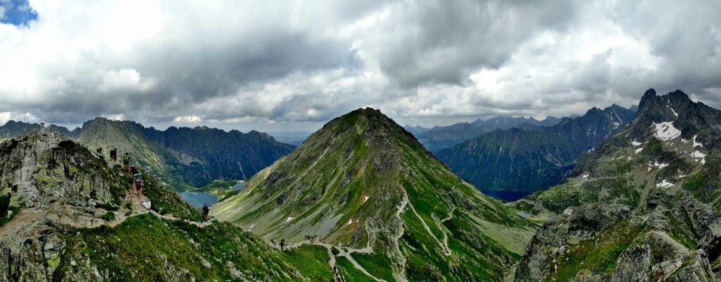
My main goal was to hike as high as possible in order to get a clear look at Rysy, the highest peak of the High Tatras. I decided on hiking to the Ostrva viewpoint, which was overlooking a valley at an altitude of 2,000 meters and should, in theory, provide an unobstructed view of Mount Rysy on the opposite side.
The High Tatras Mountains are a Natural Paradise
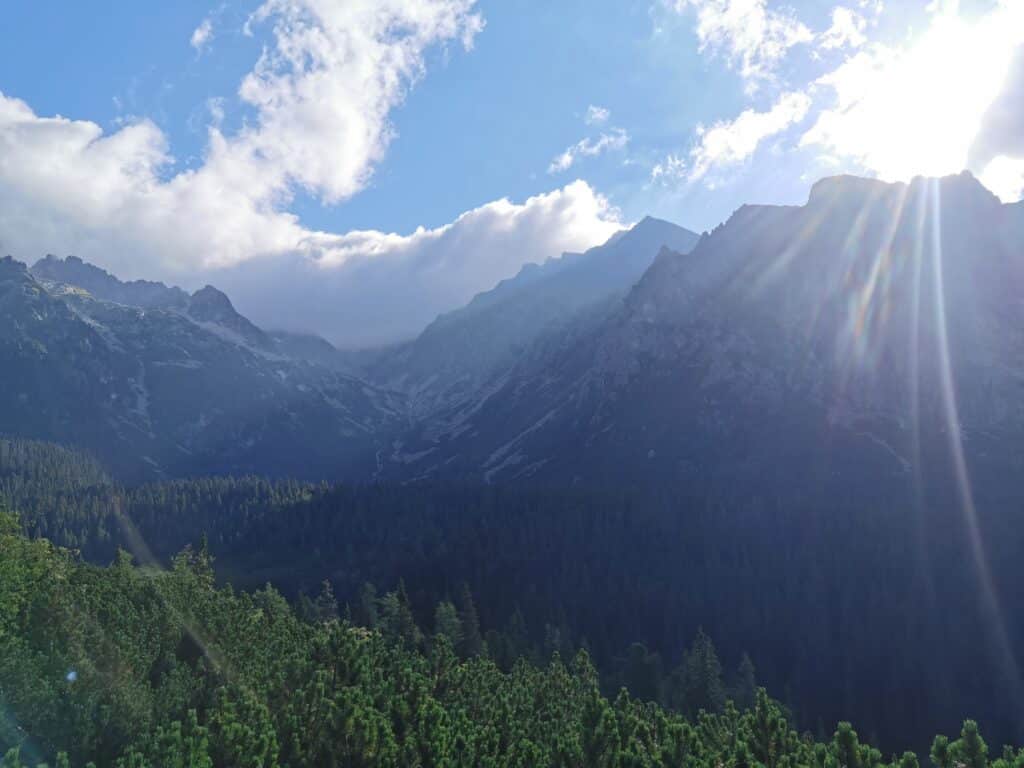
From Strbske Pleso, it is a journey of about 30 minutes to the foothills of the mountain range. From there, the entire trail led me straight uphill. The beauty of the flora and fauna, and the fact that not many people were about made the walk very pleasant.
Beautiful flowers, and untouched forests were on view all the way! After about one-and-a-half hours, I reached Popradske Pleaso, a beautiful mountain lake with a small souvenir shop and even a hotel.
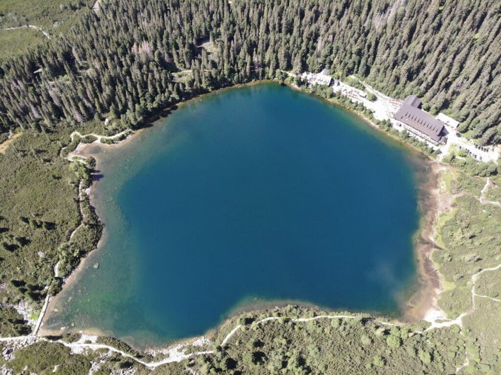
From there, I was able to see the viewpoint up in the distance. This last 30-minute stretch was the steepest part of the hike. As I slowly moved up the trail, I kept turning around to stare at the lake, which its beautiful colors intensifying as I gained altitude. After a total of two-and-a-half hours, I reached the lookout. However, it did not give me the view I was hoping for. Luckily, there is a little-known way up to a higher spot. Even steeper than the previous incline, this extra hike (15 minutes) was worth it, since it finally brought me to an entirely isolated spot on top of the mountain range. I sat down, unpacked my well-deserved lunch, and stared at the unreal mountain range in front of me, before finally heading back to my car.
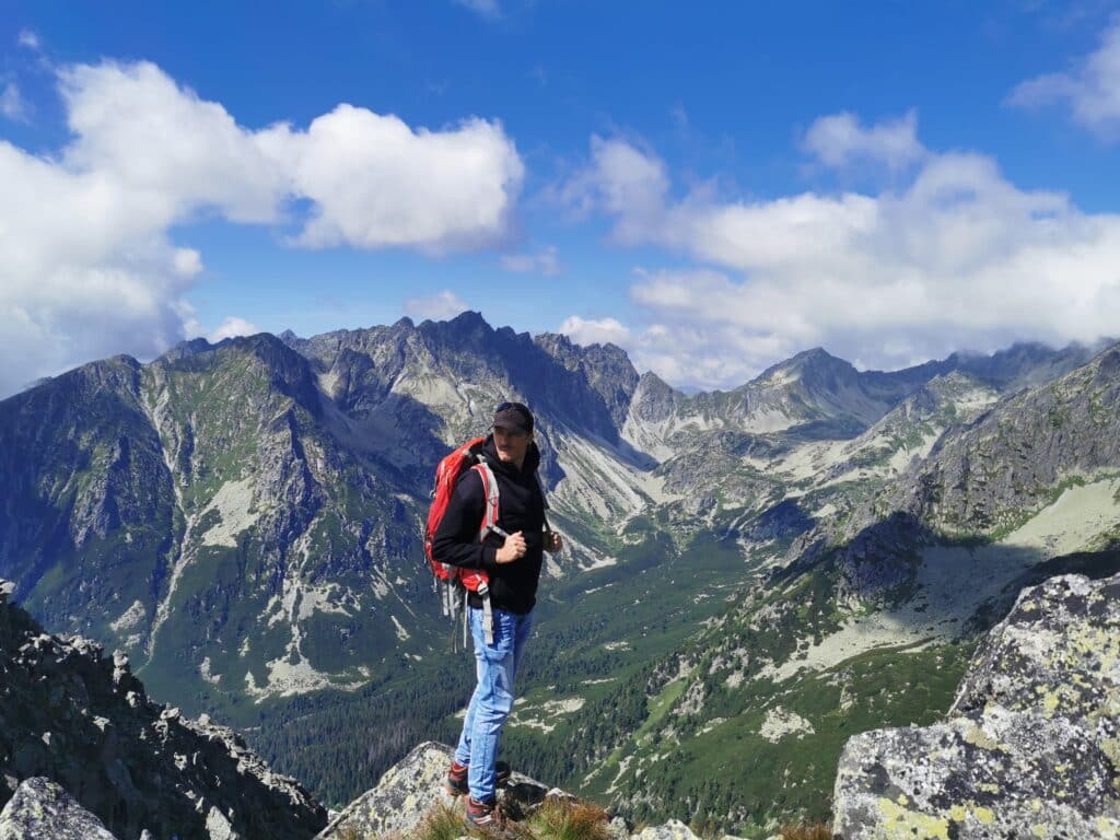
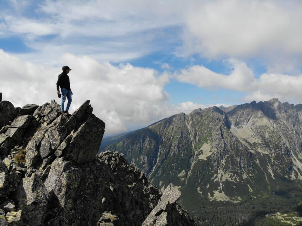
COVER: Author overlooking the High Tatras Mountains from a sharp rock
Book Your Stay near the Tatras Mountains
Use the interactive map below to search, compare and book hotels & rentals at the best prices that are sourced from a variety of platforms including Booking.com, Hotels.com, Expedia, Vrbo and more. You can move the map to search for accommodations in other areas and also use the filter to find restaurants, purchase tickets for tours and attractions and locate various points of interest!

Thomas Später, PhD, is an experienced backpacking traveler that specializes in adventurous trips around the globe. He has traveled to remote and exotic places, such as Namibia or Mongolia and focuses on landscape and wildlife photography to share the beauty of our planet with others. In 2021, Thomas published a (German) book about Overpopulation and Over-consumption (Die Überbevölkerung). With his awareness of current global issues, he uses his travels to support particularly local hotels and restaurants to raise awareness for the nature and culture of his destinations. Follow Thomas´ adventures on Instagram as well as on his website, World In Frames.